In 2017, the cost of feral pig impacts on KI were estimated at around $1 million annually, with costs borne mostly by primary producers.
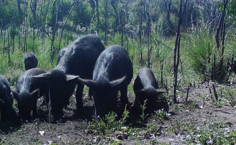
On the island, feral pigs cause severe economic impacts to pastures, grain and potato crops, and damage fences and dams. They also significantly threaten the island’s unique biodiversity, as they destroy native habitats, prey on native fauna, cause erosion, and spread weeds and diseases including Phytophthora cinnamomi.
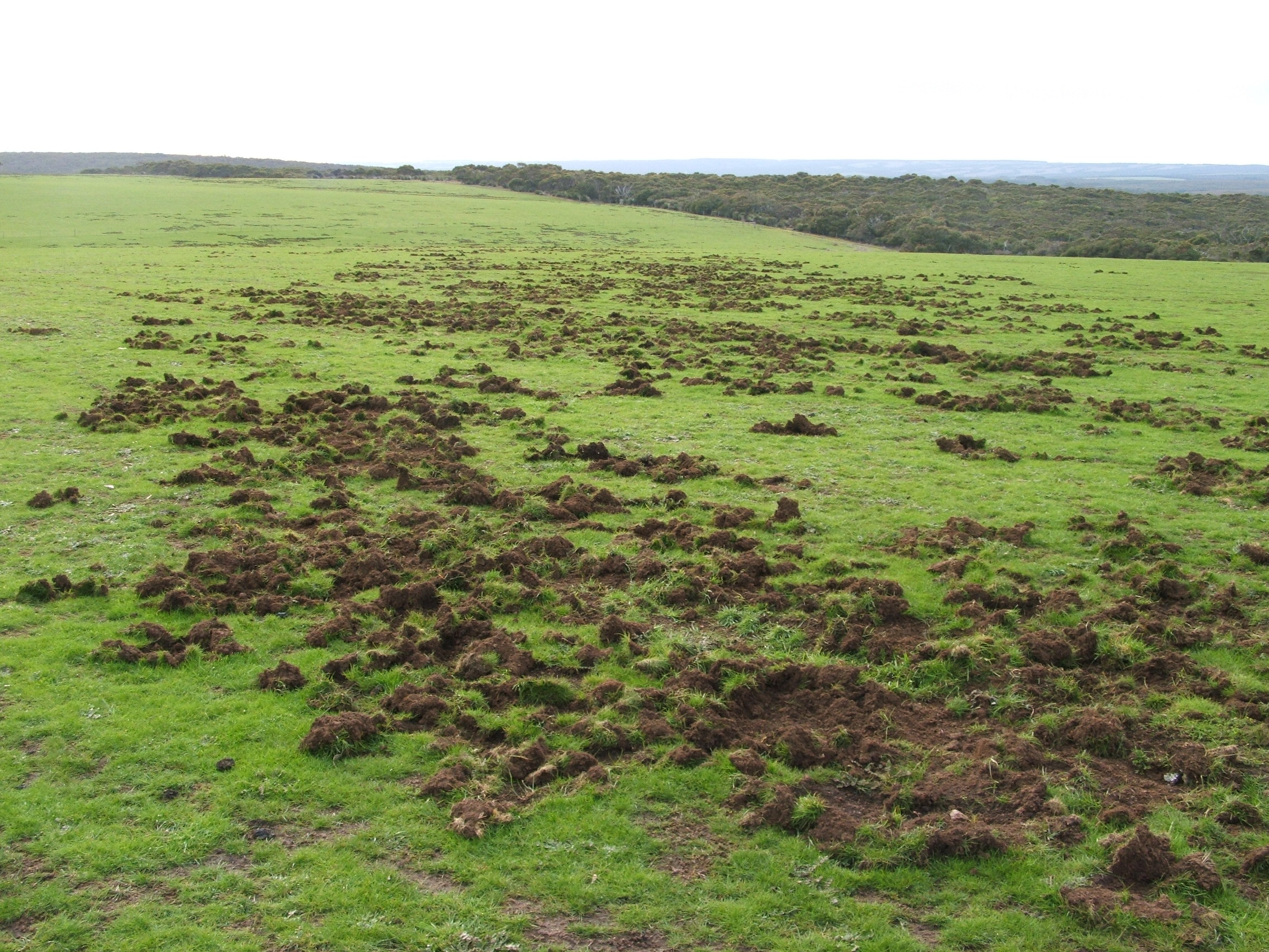
Figure 2: Damage from feral pigs on KI
In January 2020, bushfires devastated the western end of Kangaroo Island (KI). Almost half of the island was burnt, including most of the preferred habitat for the island’s estimated 5,000 to 10-000 feral pigs. Most feral pigs were killed in the bushfires, and those remaining were aggregated in small unburnt areas, with limited food available.
This presented a unique opportunity to eradicate feral pigs from KI.
A phased approach is being used to eradicate feral pigs from KI:
- The eradication phase (2020 to 2024) – primary control phase to reduce target population by using tools that can be effectively and broadly applied on a landscape scale. This phase was initially 2020-23 but was extended a further year due to the detection of 3 sows.
- Proof of freedom / confirmation phase (2024-26) – verification of eradication (to the agreed level of certainty)
In October 2020, the feral pig occupied area was divided into five groundwork zones (Figure 3). These zones were designed to utilise defined natural geographic or physical barriers (e.g., vermin proof fencing, land use, water catchments and vegetation types) to reduce the likelihood of feral pig reinvasion following knockdown.
These five groundwork zones have been engaged in steps, with mop-up efforts undertaken within a specific zone before proceeding to the next zone.
To ‘hold the line’ between cleared and infested zones, knockdown work has occurred beyond the current work zone to reduce pressure on zone boundaries. Sites where monitoring tools are placed are determined by operational staff during the mop-up phase within each zone.
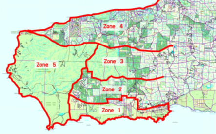
Figure 3: Five groundwork zones established on the western half of Kangaroo Island
Surveys in February 2021 indicated that feral pigs had recolonised watercourses in remote areas of western KI, which are not accessible for trapping and baiting.
Based on thermal surveys of 13.5 km2 along permanent rivers in the western half of the island in February 2021 (which were estimated to see 90 per cent of the pigs in the survey area), the estimated density of pigs was 3.3 pigs per km2. The density of pigs in this habitat is estimated to decrease by 20 per cent over winter, to 2.6 pigs per km2, when additional surface water allows pigs to disperse to other habitats.
In March 2021, the Flinders University Global Ecology group was engaged to model eradication of possible feral pig population size on KI based on different levels of investment in Thermal Assisted Aerial Culling (TAAC) activities. This modelling was informed by data from a trial TAAC in March 2021. The models were also used to predict associated probabilities of eradication.
The scenarios were:
- No further culling of pigs on KI as of 1 March 2021 –
- Eradication would not be achieved.
- Assumed that remaining 450 pigs would take 20 years to recover to population of 6,000 pigs in the western half of the island.
- Thermal assisted aerial culling over 21,000 hectares of high-quality pig habitat annually for three years supported by on-ground baiting and trapping activities
- 30 hours of thermal assisted aerial culling in summers of 2021, 2022 and 2023 targeting pigs along permanent water courses.
- A 13 per cent probability of eradication by January 2024 was predicted.
- Probability of eradication was predicted to be low due to only 15% of the total area used by pigs covered by thermal assisted aerial surveys.
- Thermal assisted aerial culling over 145,000 hectares (total pig infected area) annually for three years supported by on-ground control activities
- 250 hours of thermal assisted aerial culling in winters of 2021, 2022 and 2023 across 145,000 of pig infested area.
- Assumed that 90% of the population would be removed by thermal assisted aerial culling.
- Probability of eradication was 100 per cent by January 2023.
- This modelling was based on an estimated population of 450 feral pigs remaining after the March 2021 trial cull.
- Modelling showed that a minimum $1.89 million additional investment was required to achieve eradication by 2023.
Using this modelling (Figure 4), project staff were able to secure an additional $1.8 million investment in thermal assisted aerial culling, on top of the existing project budget.
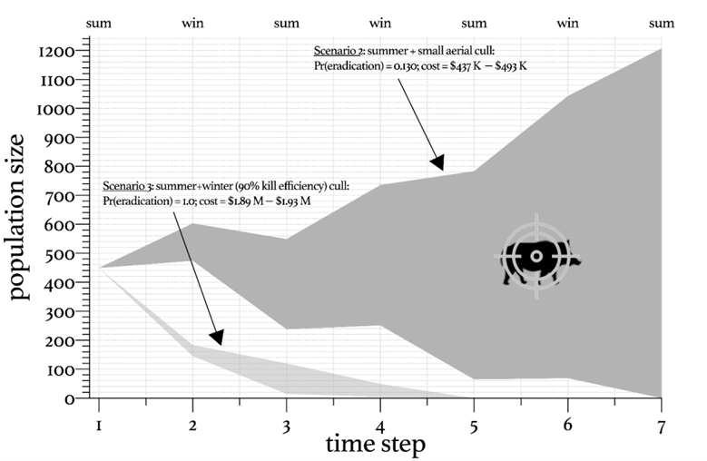
Figure 4: The Flinders University modelling showing the predicted feral pig populations under each of the different funding scenarios.
The program used Thermal Assisted Aerial Culling (TAAC) as a key knockdown tool. This tool can be efficiently used on a landscape scale, and is effective in areas with dense vegetation. Thermal assisted aerial culling uses military-grade thermal imaging to scan large areas to detect and cull pigs, so feral pigs can be detected via their heat signature even in dense vegetation. It is more expensive than conventional aerial culling, but improves on the effectiveness of the technique.
In a March 2021 TAAC trial, costing $100,000 jointly funded by the Department of Environment and Water (DEW) and Primary Industries and Resources South Australia (PIRSA), 126 pigs were culled over 36 hours of flight time – 99% of the pigs were detected using thermal imaging, compared with only 1% detected by the naked eye.
During 2021, TAAC was the primary knockdown tool.
Due to the unparalleled ability of the thermal camera to scan large areas for feral pigs, TAAC was also the primary monitoring and a mop-up tool during 2022 and 2023.
The information collected during the TAAC trial was used to establish five TAAC operational areas, that differ from those established for ground operations (Figure 5).
The TAAC operations commenced in Operation Area 1 (OP1) to finish in OP5. Each operational area was covered by modified adaptable transects that place emphasis on preferred pig habitat, vegetation types, water sources and terrain.
This approach reduces the potential for feral pigs to move behind the culling area.
The speed and field of view of aerial operations was also used to reduce the risk of pigs moving behind the Operation Area.
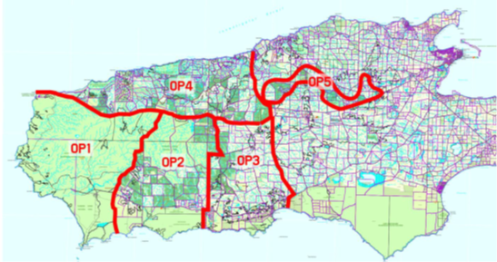
Figure 5: Five Thermal Assisted Aerial Culling zones established on the western half of Kangaroo Island
The first of the high-intensity culls took place in Winter 2021.
Over 5 weeks, a total of 243 feral pigs were culled in a total 215 hours of flight time. The cull was conducted across 188,000 ha of transects over mixed private properties and National/Conservation parks (Figure 6). The land managers provided written permission for their property to be included in the TAAC operation prior to this activity.
To our knowledge, this is the largest scale aerial cull ever conducted in Australia, and the largest scale TAAC operation in the world to date.
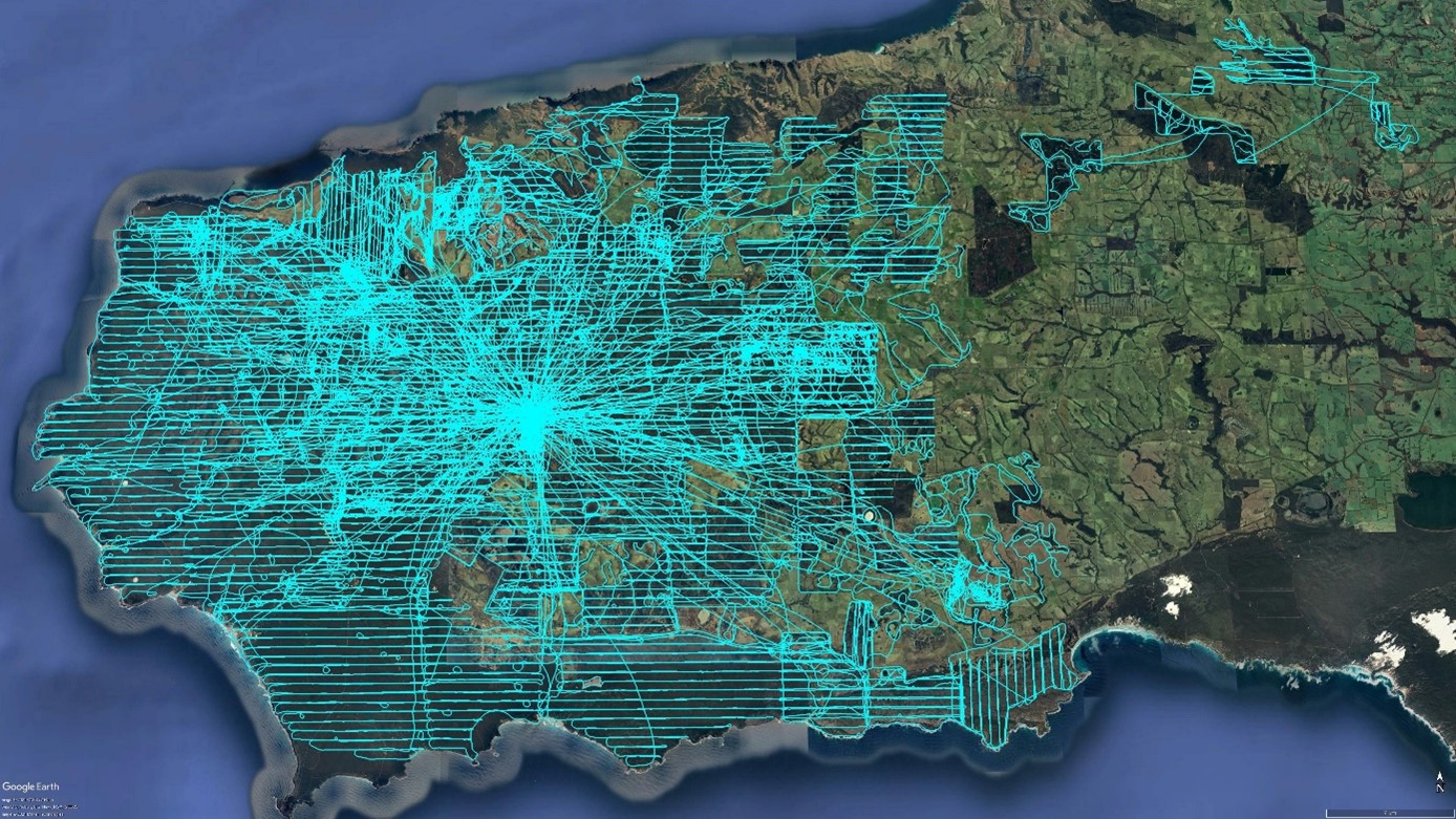
Figure 6: 188,000 ha of transects flown during the Winter 2021 high-intensity Thermal Assisted Aerial Cull. 243 feral pigs were culled in the operation over western Kangaroo Island.
In addition to the summer/autumn hotspot cull in 2022, two more high-intensity culls transecting the entire Western half of KI were conducted in 2022 and 2023.
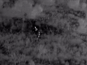
Figure 7: Photo of feral pigs detected by thermal imaging
The 2023, TAAC operation used two helicopters simultaneously, allowing more area to be covered and reducing the likelihood of feral pigs moving in behind the helicopter as areas are thermally scanned. Both helicopters flew different search layers (north to south or east to west) across the feral pig infested area, a total of three search layers were achieved:
- The first search layer (Figure 8) flew 11,305.8 kilometres over an area of 157,630 hectares. This operation covered the entire historic feral pig infested area. The search layer was east-west lines at 500-metre spacings. To minimise disturbance to livestock, flight-lines were only flown over the creek lines within paddocks, and not over the whole paddock.
- The second search layer (Figure 9) covered high priority areas where feral pigs were most likely to remain undetected because of limited ground access. A total of 7,335.2 kilometres along east-west lines at 400-metre spacings over 66,170 hectares was surveyed.
- The third search layer (Figure 10) targeted areas where feral pigs could remain undetected. A total of 5,059.9 kilometres over 48,050 hectares was covered. To improve detectability, flights were conducted north-south lines at 400-metre spacings.
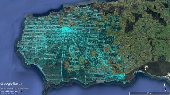
Figure 8: Tracks of the first search layer from the 2023 TAAC operation of east-west 500m-spaced transects.
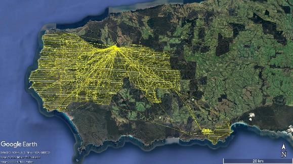
Figure 9. Tracks of the second search layer from the 2023 TAAC operation of east-west 400m-spaced transects
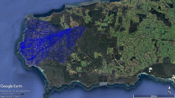
Figure 10. Tracks of the third search layer from the 2023 TAAC operation of north-south, 400m-spaced transects
Baiting, trapping, and ground shooting were the three on-ground control methods being used by operational staff to support TAAC operations.
A decision support tool was used to determine which of these control methods applied in any situation.
Baiting with HOGGONE® (Figure 11) has been the primary ground tool used. It is easy to use, and highly effective.
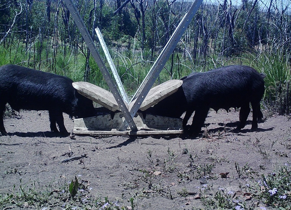
Figure 11: Feral pigs taking HOGGONE® bait from a bait box.
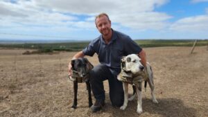
Detection dogs are trained to locate animals or plants by detecting their scent. Detection dogs are particularly effective when the target in low density, has a large home range or where the terrain and vegetation make it difficult for humans. Detection dogs locate the animal leaving the humane destruction of the animal to the handler.
 During summer, when the water has receded and any remaining feral pigs aggregate around remaining water, the detection dogs will focus on these areas. Search locations will be tracked and mapped. During the confirmation phase, detection dogs will be used for up eight weeks every year, during which time they will search remote locations for the presence of feral pigs.
Inspection sites (Figure 12) were selected due to being prime feral pig habitat, with good vegetation, palatable feed and a reliable water source. The location of these sites was determined from data collected during the eradication program and included ‘hotspots’ where high numbers of feral pigs were culled.
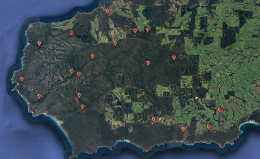
Figure 12: Feral pig inspection sites
In the confirmation phase, control staff will inspect these sites to check for physical evidence of feral pigs (such as diggings, tracks or scats) once a quarter. During the confirmation stage, staff will look for signs of visitation as well as absence of feral pigs. Data collected will assist in determining proof of freedom.
For coordination and to ensure a thorough spread of ground surveys, KI was split into 20 smaller zones (Figure 13). During the confirmation phase, ground staff will conduct a minimum of one ground in each zone every quarter.
During the summer seasons, the ground surveys will still occur in each zone but will be concentrated in waterways. Feral pigs are dependent on water for hydration and regulation of their body temperature via wallowing. The simplest way to detect the presence of feral pigs is to survey water points during hot conditions when there is less ground water available. Typically, pigs will leave tracks, diggings, and wallows, which are readily identified as being made by feral pigs.
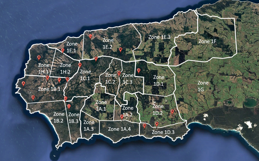
Figure 13: Ground survey zones
Monitoring cameras are a powerful tool that has been used to detect feral pigs in remote areas of KI. Recent advancements in technology enables motion-triggered images from the cameras to be sent directly to staff mobile phones. The latest technology incorporates artificial-intelligence assisted software, which auto-analyses images and distinguishes and prioritises species (Figure 14) for reporting. This system also continues to ‘learn’ and improve detection accuracy with time. The technological breakthrough is useful for big programs with many cameras that may generate too many images for human operators to process effectively.
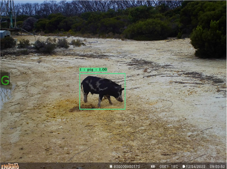
Figure 14: An image taken from a 4G cellular camera of a feral pig; the green square around the pig indicates the eVorta software has made a detection.
The program currently operates a network of 200-250 4G cameras at any one time (Figure 15) – it is the largest network of 4G AI cameras used for invasive species monitoring in Australia. If a feral pig is detected by a camera, staff are automatically alerted, enabling them to respond immediately. The network will also provide evidence of the absence of feral pigs at each location.
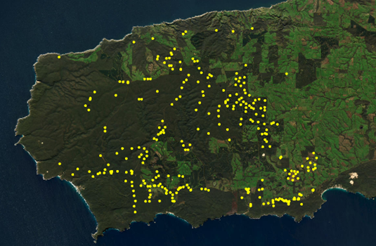
Figure 15: The 4G monitoring camera network on Kangaroo Island
Some areas in western KI do not have cellular reception and require deployment of standard cameras (i.e., without 4G connectivity and eVorta software to auto-monitor the area). These cameras function in the same way as the 4G network but require manual checking of the cameras at regular intervals. Standard cameras are an important tool because they allow ground staff to monitor areas without cellular reception; these areas are typically remote and overlap with ideal feral pig habitat (see Figure 16). From June 2024, a minimum of 65 standard cameras have been deployed across western KI and checked every quarter.
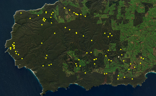
Figure 16: The 91 standard cameras deployed over Western Kangaroo Island.
eDNA (environmental deoxyribonucleic acid) is a cutting-edge scientific monitoring tool that can be used to detect the presence of feral pigs within the environment by testing for miniscule amounts of their DNA. Water samples for eDNA analysis are taken at strategic locations, such as dams or rivers where feral pigs could wallow and leave behind physical evidence of their visit, such as skin cells and hair. The water samples are processed and analysed for the presence of feral pig DNA. Existing research shows that feral pig DNA will persist in the environment for around 75 days before breaking down to undetectable volumes.
Samples were collected during the eradication phase and continue to be collected during the confirmation phase. A total of 25 sites (Figure 17) are sampled by ground staff every two months when water is available. The aim of this component of the monitoring program is to demonstrate that all water systems within priority catchment areas are free of feral pigs – and that they remain free of feral pigs during the confirmation phase.
Samples will be analysed from most recently collected samples. If significant positive results occur, it can direct control staff to areas where feral pig eDNA detection occurred, allowing increased investigation in the area in case there are feral pigs present.

Figure 17: Locations of the eDNA samples sites across Western KI