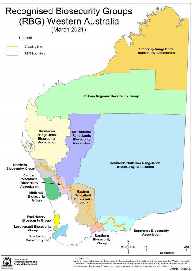
A Recognised Biosecurity Group (RBG) is a mechanism established under the Biosecurity and Agriculture Management Act 2007 (BAM Act) in Western Australia. It enables landholders and managers to develop a coordinated approach to declared pest control in their area, supporting their individual responsibilities as land managers. As of June 2024, fourteen RBGs are in place in Western Australia.
To access funding under the BAM Act, RBGs must provide the Director General of the Department of Primary Industries and Resource Development (DPIRD) with a Declared Pest Action Plan. This plan informs the determination of the Declared Pest Rate (DPR), which the Director General requests the Minister to impose. DPRs are matched dollar-for-dollar by the state government. This funding can only be used for declared pest control under an approved Declared Pest Action Plan.
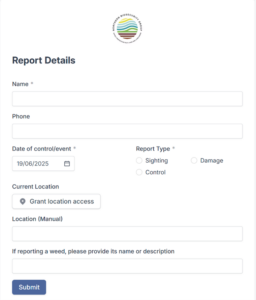
Landholders are encouraged to report any sightings and damage to the RBG’s via their websites. The image below shows the reporting form from the NBG’s webpage. If the landholder is reporting damage, further questions are asked regarding area of damage, cost to repair damaged asset and estimated cost of damage.
Whatsapp messaging groups are utilised in the CWBA and MBG, with a smaller number of landholders, and are a quick and reliable way of communicating feral pig presence for immediate action and direct engagement with the landholders. This has proved to be a successful communication channel for these groups.
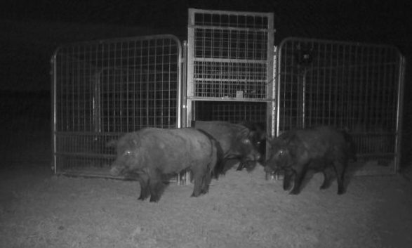
All three RBGs have invested in a range of high-quality trapping equipment, including PigBrig and Matlock traps. Traps can be set up by the local LPMT or monitored and set by the local landholder. The Matlock trapping system allows landholders to monitor feral pig numbers in and around the trap via a remote real-time video link. The door is closed via an app only when all pigs have entered the trap, preventing pigs from becoming trap shy.
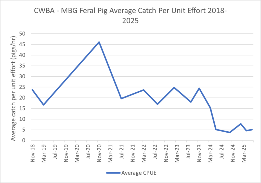
Central Wheatbelt Biosecurity Association (CWBA) and Midlands Biosecurity Group (MBG) joint aerial program
For their 2023-2024 Operational Plan, the Central Wheatbelt Biosecurity Association (CWBA) and Midlands Biosecurity Group (MBG) jointly adopted a new strategy inspired by the Kangaroo Island Feral Pig Eradication Program. The feral pig area was divided into four zones and four aerial culling programs were conducted in August and November 2023, and February and May 2024. The goal was to spend increased hours in each zone to cull every feral pig encountered, without being limited by flying hours (within budget). This approach has significantly lowered the number of feral pigs aerially culled in the region over the last 12 months.
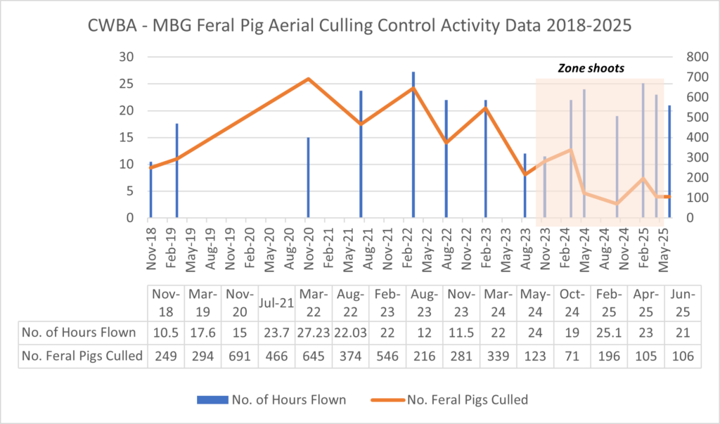
This new approach was featured in the NFPAP newsletter in the July 2024 edition and the April 2025 edition.
Northern Biosecurity Group
In the past, the NBG conducted one aerial cull a year, increasing flying hours each year and consistently culling more feral pigs. In 2022, the NBG also conducted a second aerial shoot.
In 2025, the NBG adopted a zone approach for the management of feral pigs.
From July 2025, the approach will involve completing groundwork in a zone, i.e. trapping and baiting, for a period of 6-12 weeks before an aerial cull, and again after the aerial cull to try and limit the reestablishment of pig populations. This approach reduces the pig density and allows the identification of key areas of pig habitation. Furthermore, it allows incidental control of other declared pests in the zones, such as feral cats and foxes.
Average catch per unit effort (CPUE) is a basic measure of control operation efficiency. A declining feral pig population should result in a decrease in CPUE over time.
In the DPIRD’s review of a subset of NBG’s aerial cull data, it was determined that despite extensive efforts in the NBG region between 2018-2024, the feral pig average catch per unit effort did not decrease significantly. This indicates that the efforts did not result in a substantial decline in feral pig population.
The average CPUE for feral pigs in the CWBA region increased between 2018 and 2020. However, since 2020, CPUE has decreased, indicating a decline in feral pig abundance.
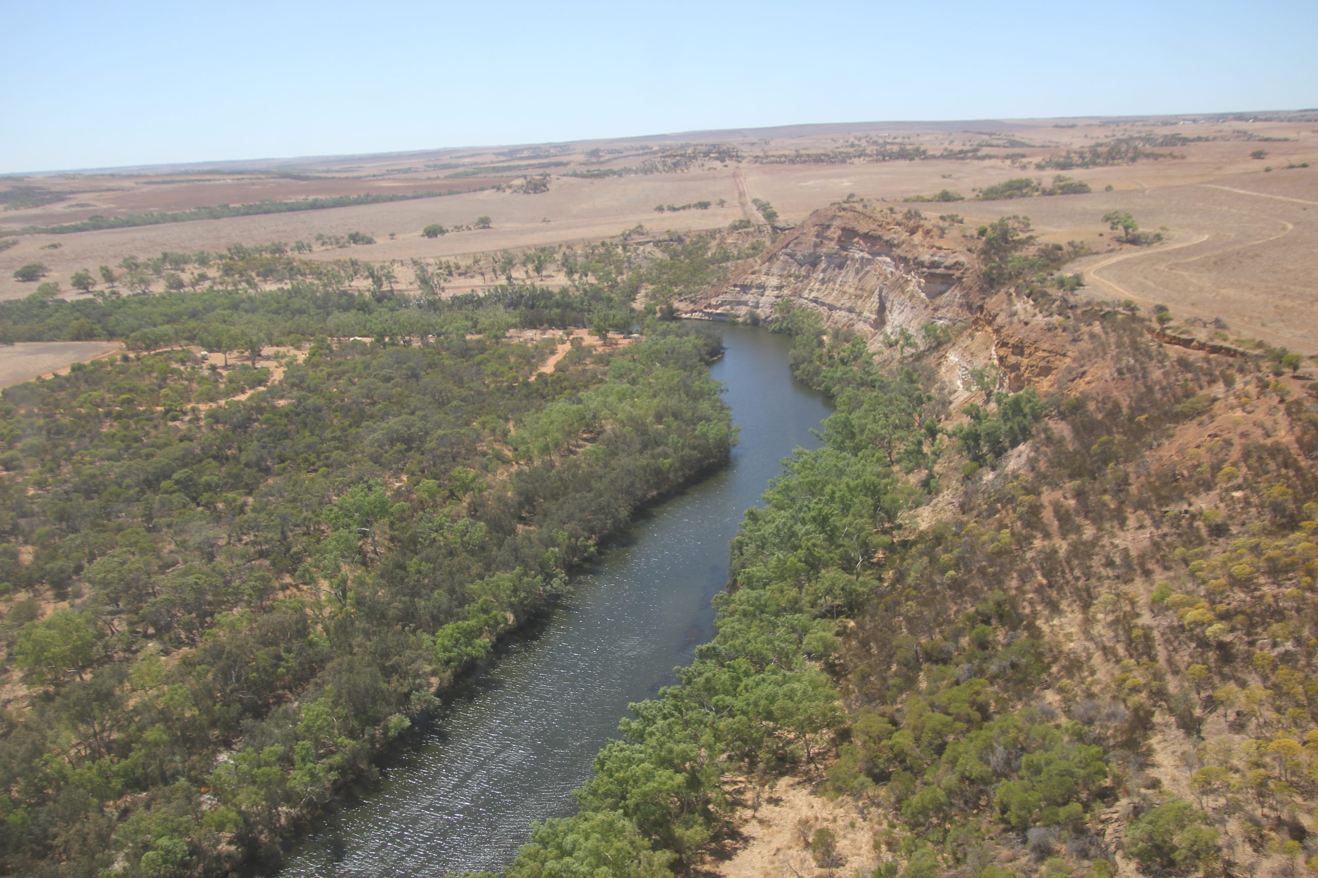
A camera trap monitoring program was initiated in January 2018 to assess the impact of feral pig management strategies across the region. This program was conducted in partnership with the Department of Primary Industries and Regional Development (DPIRD). Thirsty six cameras were installed in the Northampton project area where annual aerial shooting programs are conducted by the NBG.
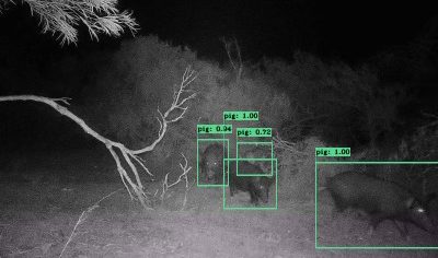
More recently, the three RBGs have collaborated to invest in a feral pig and wild dog camera surveillance project. This two-year initiative was jointly funded by the Department of Agriculture, Fisheries and Forestry, as part of its $30.3 million Established Pest Animals and Weeds Management Pipeline Program, and DPIRD. An additional 90 cameras were installed throughout the three RBG regions. Automated image analysis, including facial recognition using eVorta software, has been used to monitor populations of invasive animals.
This data is being used to enhance understanding of changes in population sizes in response to coordinated management programs and seasonal conditions. Automated image analysis is providing timely information to individual landholders and the RBGs about feral pig and wild dog movements and occurrences. This system improves the cost-efficiency of image processing and analysis by eliminating the extensive time and labour required for manual data collection from SD cards and image trawling.
Additionally, a project funded by the Centre for Invasive Species Solutions, in collaboration with DPIRD WA, DAF QLD, and DPI NSW, was conducted to develop automated software to detect pest animals, including feral pigs, from thermal imagery. More information about this project can be found here.